This section is under construction
This section has been set aside to add maps of the local area, with more being added as we progress, so please check back.
We'd welcome any thoughts for expanding this section of the site and invite your participation as we go forward.
Please Contact Us with comments, additions, suggestions.
In the meantime, please enjoy the maps on this page.
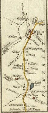
Old Road Maps of the local area, c. 1785
These maps of the area between Bristol (GLS/SOM) and Bath (SOM), the area between Chippenham (WILTS) and Cold Ashton (GLS),and the area around Wells, (SOM), come from Captain Daniel Paterson's...
''Paterson's British Itinerary
- being a new and accurate delineation
and description of the direct and principle
cross roads of Great Britain.''
Published by Carington Bowles,
London, 3 Jan. 1785.
 |
 |
Maps on this page courtesy of Clare
